Understand the town before the venue
Start with Livigno's civic centre, streets and high-valley geography before reading its Olympic role.
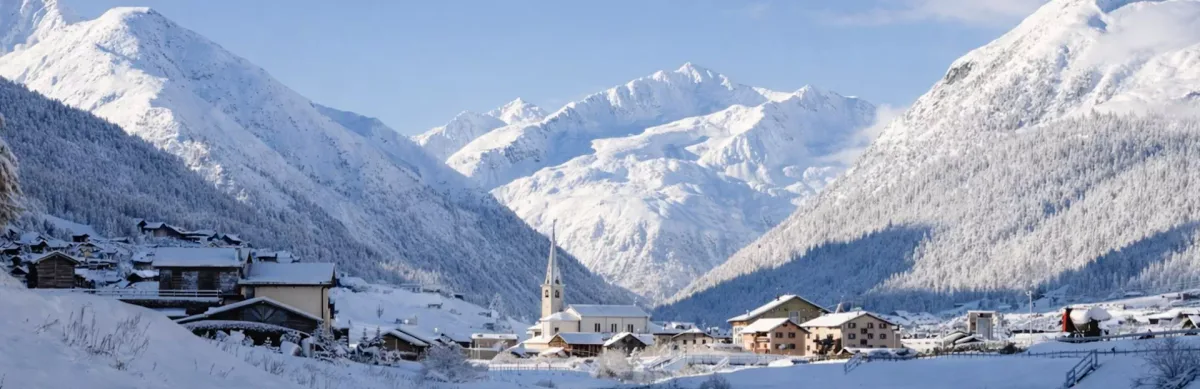
Read an alpine town shaped by altitude, isolation and snow culture.
Walk through Livigno's pedestrian centre to understand how altitude, freestyle sports, duty-free town life and Olympic ambition shaped a remote alpine community into one of the central places of Milano Cortina 2026.
Start with Livigno's civic centre, streets and high-valley geography before reading its Olympic role.
See how altitude training and freestyle disciplines grew from local conditions, not from an imported event narrative.
Follow a self-guided route through the pedestrian centre with enough context to make the town coherent.
Editorial perspective
Livigno's Olympic role makes sense only if you first understand the valley: its altitude, isolation, commercial identity and long relationship with winter conditions.
GeoBeat treats the 2026 story as a lens on place. The walk asks what a global sporting event means for a small alpine community with its own snow culture and memory.
A concise preview of what you will hear along the walk.
Livigno's public square marks the centre of a town that has long lived at altitude — and then became part of a global sporting event on its doorstep.
The commercial spine of Livigno carries the daily rhythm of residents, ski tourists and athletes who share the same alpine streets.
The parish church is a community landmark built over centuries in a valley long cut off from the rest of Italy — a place where devotion and resilience have always been inseparable.
Above 1,800 metres, Livigno's elevation has made it a destination for endurance athletes long before the Olympics arrived. The valley's geography tells that story directly.
And more along the route.
The route keeps Olympic ambition tied to local geography.
A clear route, written for listening while you move.
Each stop is chosen for cultural meaning, not as a generic checklist.
The route connects places into a simple narrative you can follow on foot.
The text is shaped for listening in place, with enough context to stay clear.
The walk gives you orientation without replacing the full VoiceMap experience.
Online facts can list venues and elevations. GeoBeat turns those fragments into a town walk, connecting altitude, streets, sport and memory while you are there.
You want to understand why Livigno matters in the geography of the Winter Games.
You like reading a mountain community through streets, church, shops and public space.
You prefer a clear self-guided route through the centre, without a fixed group.
You want the Olympic story framed through local life rather than event hype.
Follow the town centre and understand how altitude, snow culture and Olympic legacy meet in one alpine community.